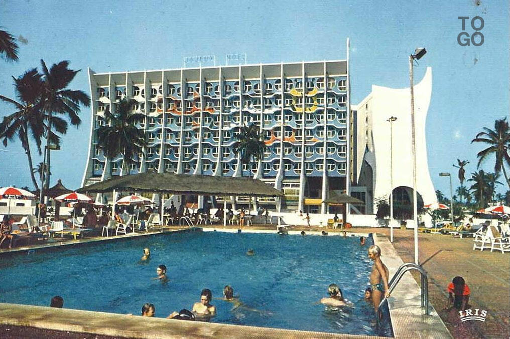
Souvenirs of the Hôtel de la Paix
Presentation
Designed as a prestigious international hotel complex, the Hôtel de la Paix occupies a strategic position on the seafront, in a privileged location in the capital. The building is 7 storeys high on a first floor, and comprises mainly two V-shaped wings, offering the vast majority of the 216 rooms a direct view of the sea. In addition, a 16 pavilions, each housing two suites, have been built in a landscaped park to the west of the main building. an entertainment area with a swimming pool between the building and the pavilion park.
Construction of the hotel began in August 1972 and was completed in September 1974, with the inauguration taking place on January 9, 1975. Unfortunately, since 2005, the hotel has remained abandon. By March 2023, there was talk of demolishing the building. In order to safeguard its heritage, Mitsio Motu proposed to map the site using two methods.
3D Cartography
In order to preserve the architectural heritage of this building and highlight its specificity, which is representative of its era, Mitsio Motu's team undertook a mission to acquire images by drone in order to reconstruct the building as a 3D model.
This involved planning drone flights to operate in the field. Some 2,200 images were taken of the site. These images were used to generate a 3D model of the building. The video below shows the result of the acquisition and reconstruction and reconstruction.
Full details of how to set up this project are available in the project documentation.
Download the 3D model (GLTF format)
Architectural models
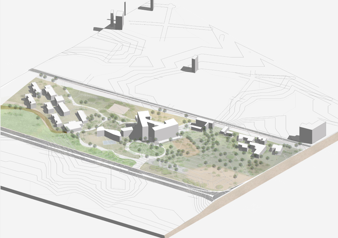
In parallel with the 3D reconstruction, a team of architects and urban planners mapped the site in order to classify and appreciate the different types of buildings present in the area. The image above shows an axonometric view of the Hôtel de la Paix site. Axonometry is a graphic representation method widely used in architecture to present a project in three dimensions. It enables a building or space to be represented with realistic proportions and spatial relationships, while providing an overall vision of the structure.
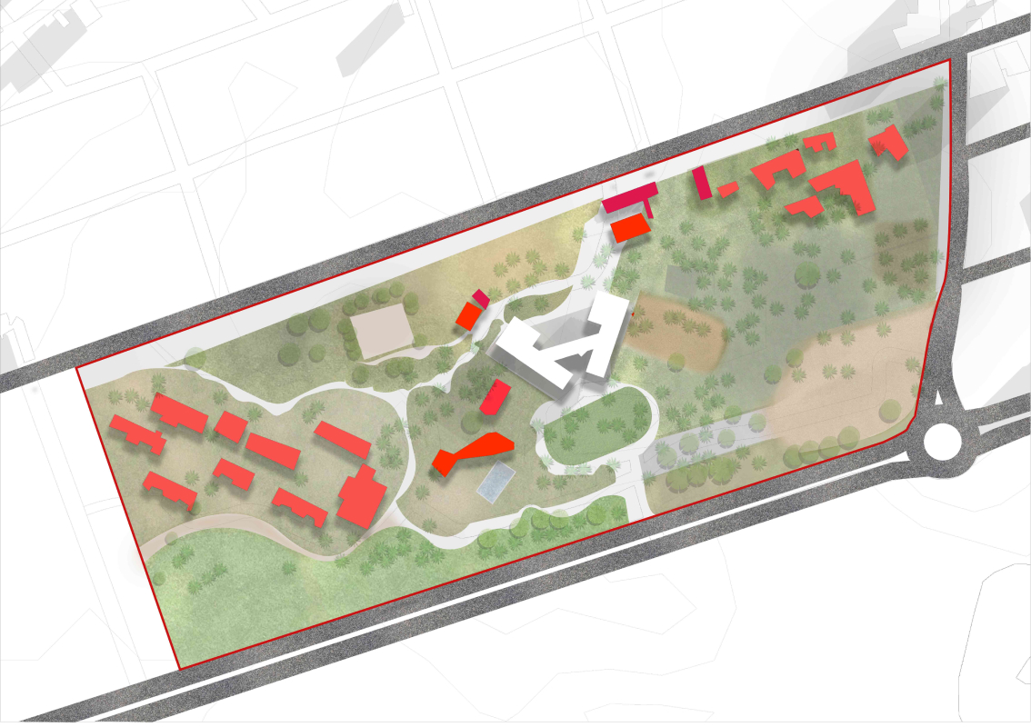
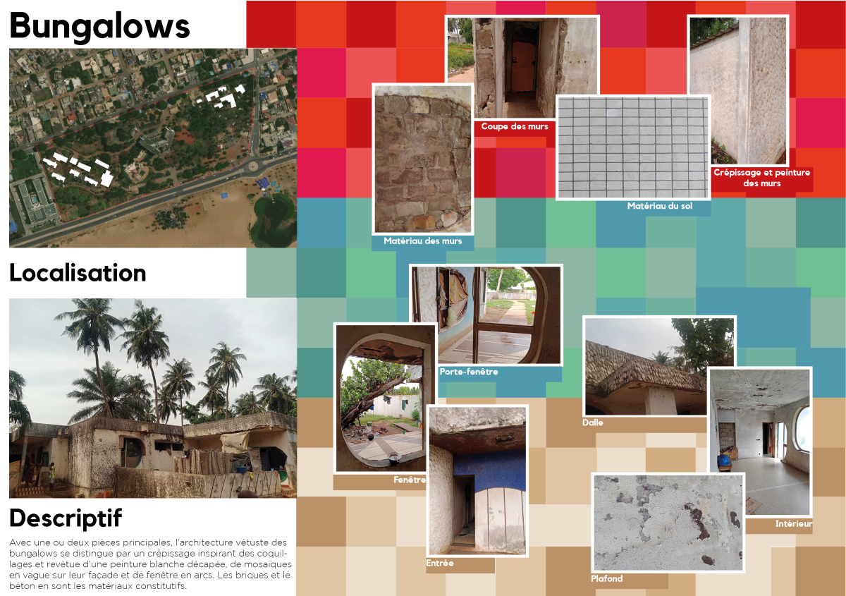
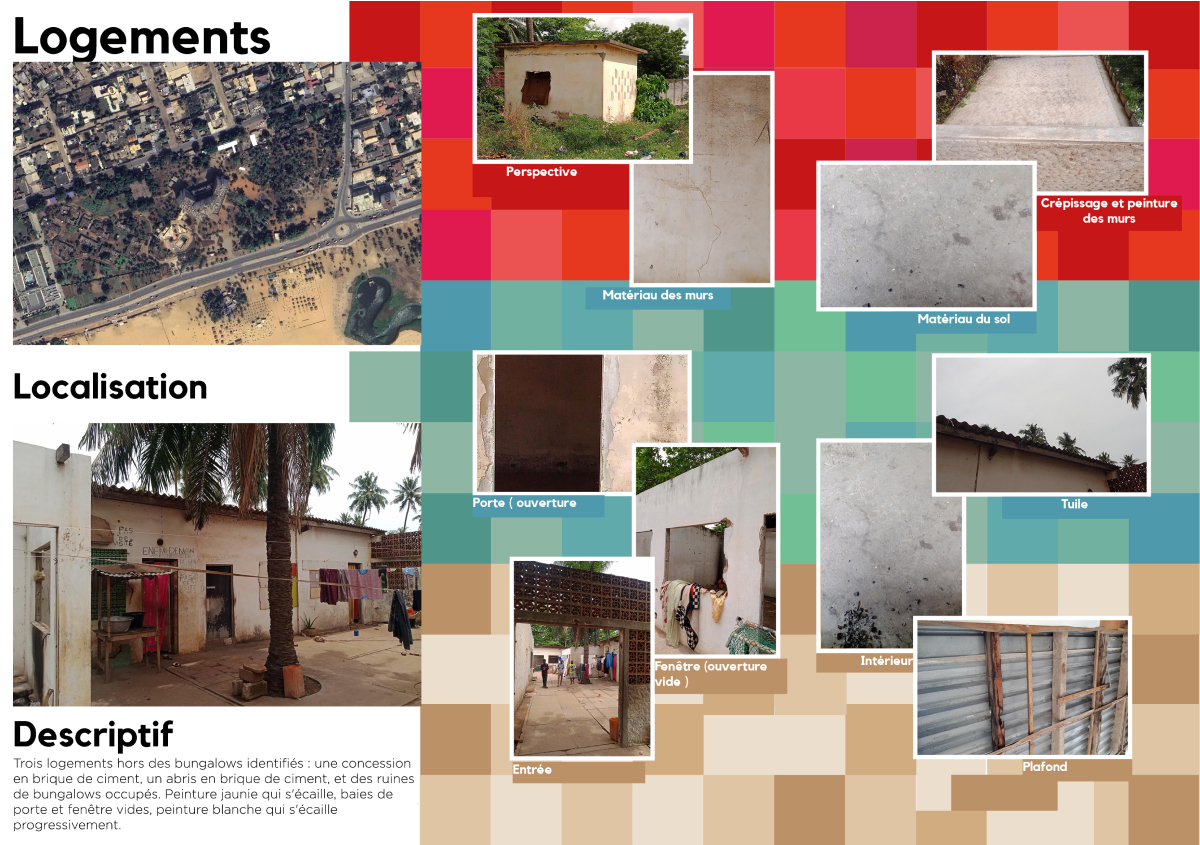
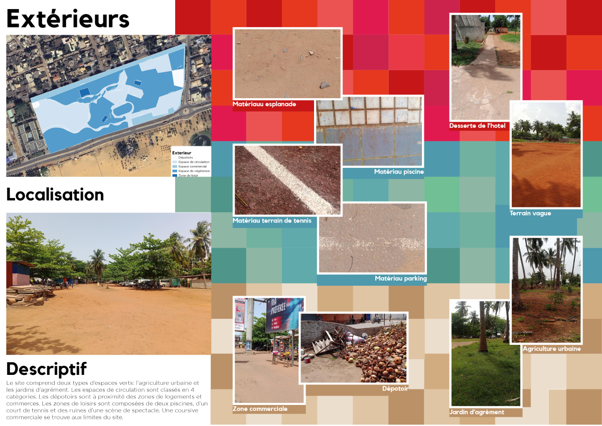
Information sheets have been drawn up for each type of building, indicating the materials used in its construction and its architectural features.

Our partners
3D mapping was proposed and implemented by Adèle Pluquet et Adrien Ludwig as part of their collaboration with Mitsio Motu in 2023.
The axonometries and descriptions of the architecture of the hotel and its surroundings were produced by a team of urban planners and architects including All-Glory Houenassou, Isreal Obi, Abiel-Verén Fidegnon and Steven Montcho, with the support of architect-urbanist Monica Coralli.
We would like to thank the Union Européenne, whose funding has made these projects possible.
We would like to express our gratitude to the Flying Labs Togo team for their support throughout the project.
Mitsio Motu is a company operating in West Africa and France, building information systems to provide universal access to basic services.